Répondez à tout événement grâce à des évaluations rapides optimisées par l'IA
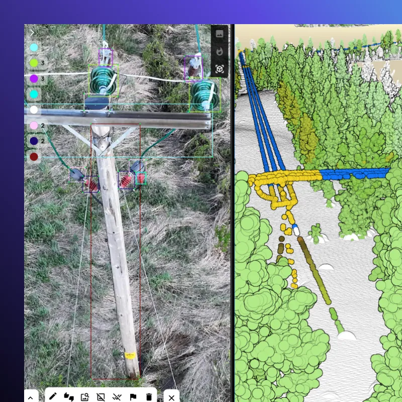
Lorsque chaque heure compte, Arkion fournit des informations exploitables en quelques heures, et non en quelques semaines. Notre IA traite rapidement les données d'inspection visuelle et LiDAR pour localiser, classer et hiérarchiser les dommages sur votre réseau, aidant ainsi les équipes à rétablir le service plus rapidement et en toute sécurité.


Des analyses plus rapides quand le réseau en a le plus besoin

Des informations sur les dommages disponibles quelques heures seulement après la capture.

Identifiez les structures dangereuses et planifiez vos interventions sur le terrain en toute confiance.

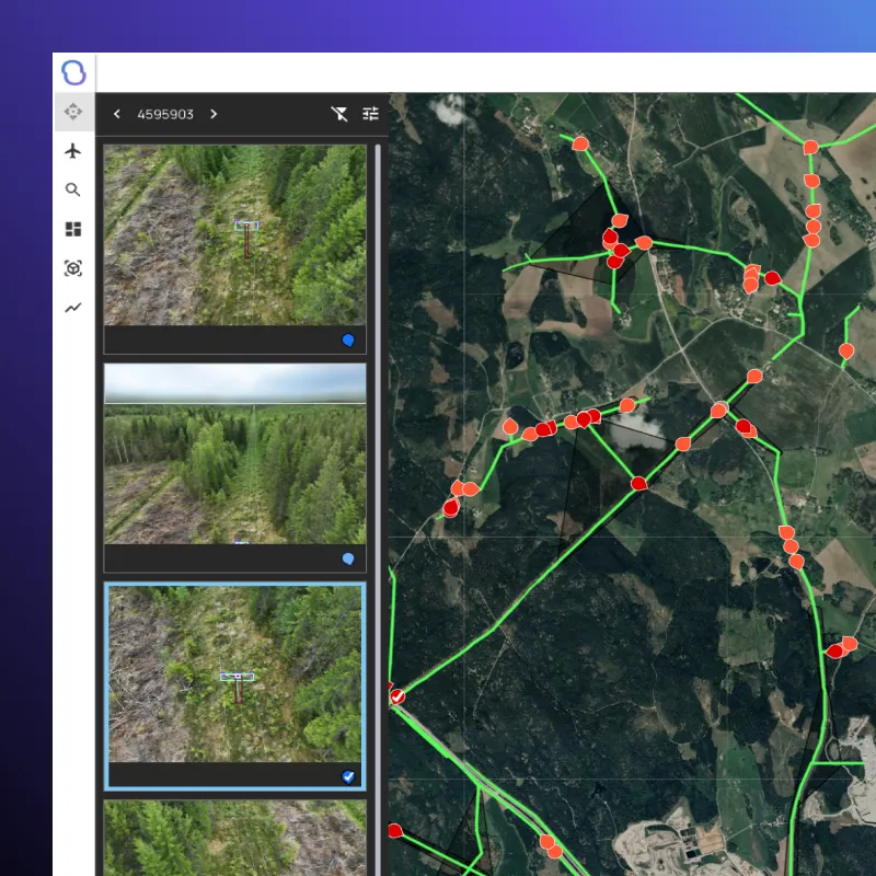
Combinez les images, les données LiDAR et les données prédictives pour coordonner une intervention efficace.
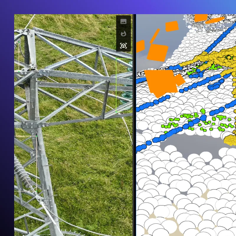
Nos modèles d'IA traitent des milliers d'images pour détecter les poteaux cassés, les traverses effondrées, les lignes tombées au sol et les débris.


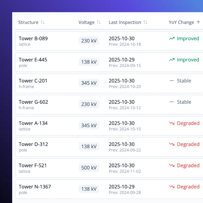
Chaque problème détecté est automatiquement évalué en fonction de sa gravité et de son impact sur la sécurité, permettant aux équipes de se concentrer sur les réparations les plus urgentes.
Les résultats sont transmis directement vers votre AMS ou SIG, générant des tâches de réparation prêtes à être assignées et des résumés d'incidents.
Combinez les données LiDAR, thermiques et RVB pour une connaissance situationnelle complète, même lorsque les conditions rendent l'évaluation manuelle impossible.
Des analyses rapides pour un rétablissement plus sûr
Les évaluations rapides sont directement intégrées à vos systèmes existants. Les rapports et les listes de défauts hiérarchisés sont automatiquement exportés vers votre AMS ou SIG, offrant aux opérateurs un contrôle total de la situation sans traitement manuel.
FAQ

All customer data remains the property of the client. Arkion only processes data under explicit agreement and does not share or reuse customer data outside the scope of contracted services.
Arkion minimizes and pseudonymizes all personally identifiable information. Images containing individuals or private property are anonymized using automated image-blurring and masking tools. GPS data is pseudonymized to prevent re-identification.
Data is stored on AWS servers, which can be configured in any AWS region to comply with national or organizational data-residency requirements. Utilities can choose hosting within Europe, North America, or other supported regions.
Arkion uses AWS cloud hosting with all data encrypted in transit and at rest. The architecture is built on a secure pipeline including S3, SQS, and Step Functions. Access controls, audit trails, and regular penetration testing by accredited third parties ensure that customer data remains protected.
No. Arkion focuses entirely on AI analysis and visualization — transforming collected data into actionable insights. However, Arkion collaborates with trusted global partners who perform drone, helicopter, and other inspection flights. If needed, Arkion can connect you with qualified operators to support end-to-end inspection workflows.
Arkion serves utilities and service providers globally. The platform supports multi-language, multi-region deployments and is used by customers across Europe, North and South America, and parts of Asia and Oceania. Cloud hosting can be configured regionally to meet local data-residency and compliance requirements.
Yes. Arkion complies with the EU’s General Data Protection Regulation (GDPR) and equivalent frameworks in other jurisdictions. Data collection, processing, and retention policies are transparent and available upon request.
Yes. Arkion supports data captured from helicopters, ground vehicles, and fixed cameras in addition to drones. As long as the imagery or LiDAR data meets basic resolution and overlap standards, Arkion’s AI models can process and analyze it with the same precision and accuracy.
Yes. Arkion maintains an international network of experienced data-capture partners who can assist with flight planning, data collection, and secure upload to the Arkion platform. Each partner is vetted for safety, regulatory compliance, and quality standards.