


Benefits
Quantified distances for compliance and safety.
Prioritize trims by risk and proximity.
Accurate 3D models for planning and analytics.
High-precision segmentation at scale
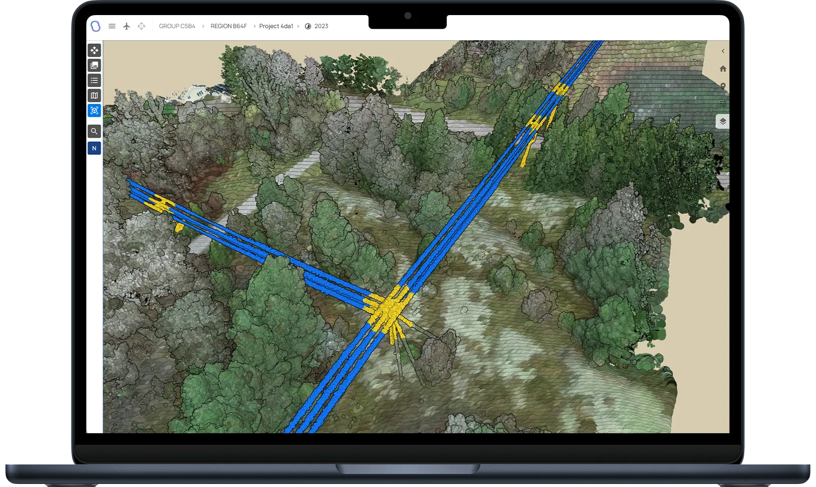
AI models classify millions of points into conductors, towers, crossarms, vegetation, and ground. Results are topology-aware, enabling corridor-wide analytics and per-span metrics.

Automatic ground and vegetation clearance alerts
Automatic calculations for ground clearance, vegetation encroachment, and conductor-to-structure spacing—summarized by span, circuit, and region, with thresholds tuned to your standards.
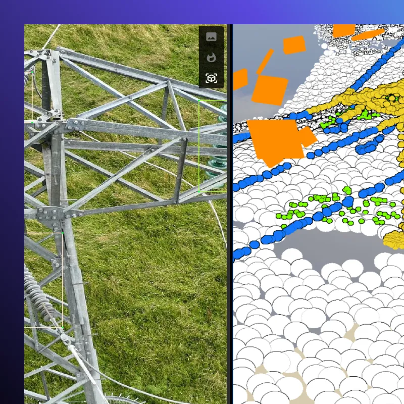
3D combined RGB and thermal— for the complete picture
Jump from point cloud to image to thermal in a click. Validate a clearance flag with the original photo, or correlate a hot spot with nearby vegetation—without leaving the platform.
Use cases

Proactive trims by measured risk, not guesswork. Lidar analysis gives a clear picture based on your internal rules and standards.
.webp)
Rapid structural checks and debris mapping. Lidar analysis can rapidly show the most dangerous and impacted stretches.
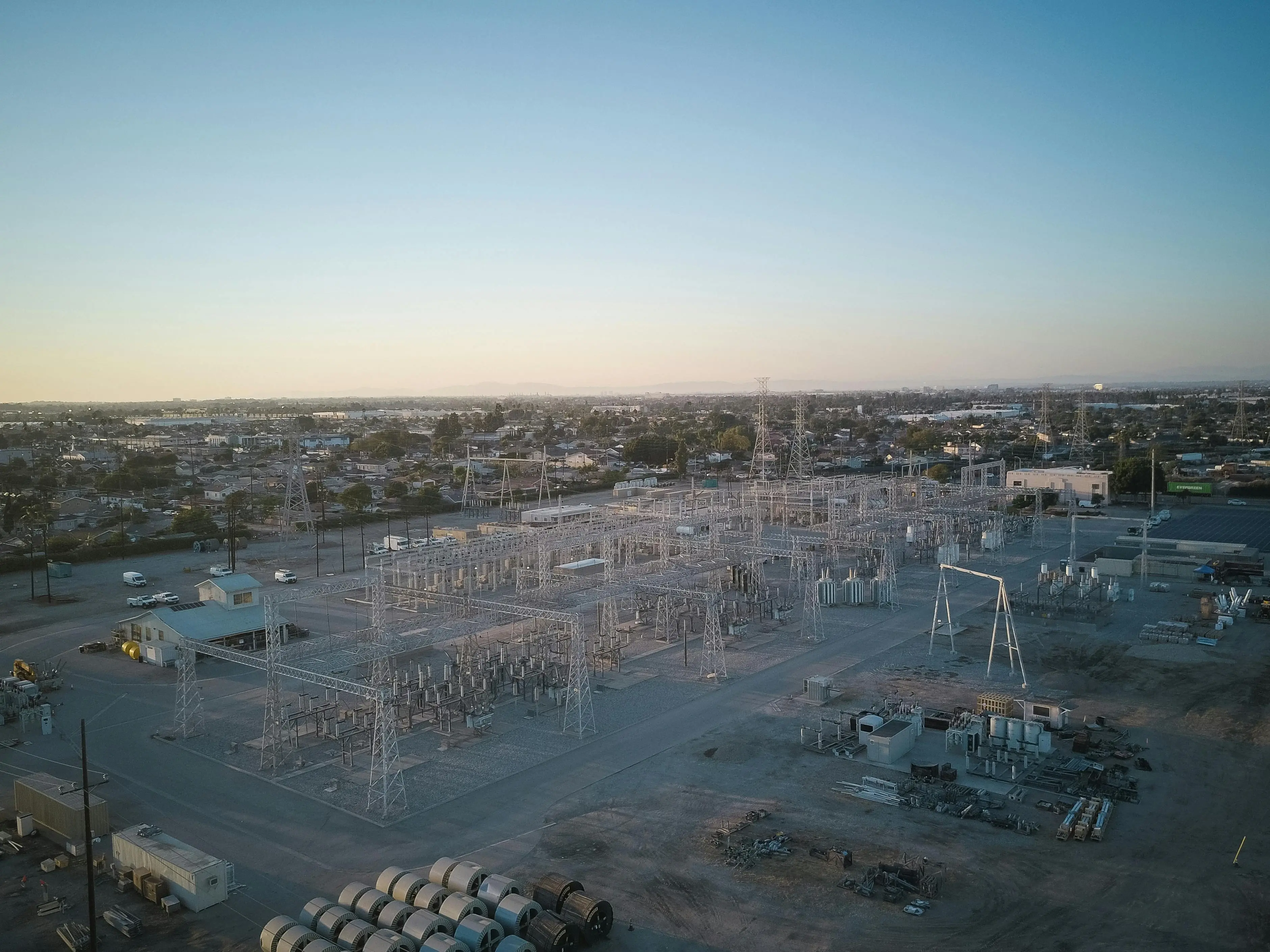
3D-aided structure and component mapping for clean records. Simplify both overhead powerline and substation review.
FAQ
Don’t hesitate to contact us if you have any questions

Arkion integrates with most leading Asset Management Systems (AMS), GIS, and work-order tools through a secure two-way API. Common integrations include SAP, Trimble, Maximo, and ArcGIS, among others, enabling seamless data flow between systems.
Getting started involves three simple steps: 1) Data Review – Arkion reviews your existing data for quality and compatibility. 2) Pilot Analysis – A limited-scope pilot demonstrates analysis accuracy and workflow integration. 3) Scale-Up – The solution is rolled out across your grid, with dashboards, reports, and integrations configured to your needs.
Arkion is a secure, browser-based platform. Users can log in to review data, filter insights, and plan actions through an intuitive map interface and dashboards. Results can also be exported as reports or pushed directly into enterprise systems via API.
Not usually. Arkion maintains a library of more than 100 trained models that cover common components and defect types. These can be immediately applied during onboarding. Custom development is reserved for unique equipment types or conditions outside the existing dataset.
Arkion’s platform supports all major inspection and analytics use cases, including maintenance, vegetation management, asset inventory, and post-storm assessments — across low-, medium-, and high-voltage networks. Additional models can be developed for specialized needs.
Arkion typically requires geotagged imagery or LiDAR data, along with structure metadata such as pole IDs or coordinates. Optional inputs like thermal imagery or flight logs can enhance results but are not mandatory.
Arkion supports industry-standard formats including JPEG, TIFF, PNG, and GeoTIFF for images, LAS/LAZ for LiDAR, and CSV or shapefile-based metadata. The platform can also connect directly to cloud storage or API-based data feeds for seamless ingestion.
Model retraining or fine-tuning is included in service agreements when needed to maintain performance. For new object types or regions requiring dedicated dataset development, Arkion may propose a scoped AI model development project.
Yes. Arkion’s in-house AI and electrical-engineering experts regularly develop custom models for utilities with unique assets or inspection needs. These models are integrated into the platform and benefit from Arkion’s full QA and visualization ecosystem.