
Quality assurance that delivers delivers certainty and accuracy
Let a team that has inspected more than 100 000 KM help inspect you grid. With a multi-tiered review system that includes Arkion's regular AI and rigorous quality control and assurance process you can rest easy knowing you will the get the most complete picture possible of your grid's health.


Adapted to your exact reporting structure
With human-in-the-loop, you can get results down to the most minute potential issue in the grid, meaning everything from the most critical and urgent but also the issues that could cause issues in the future for your grid.

The process

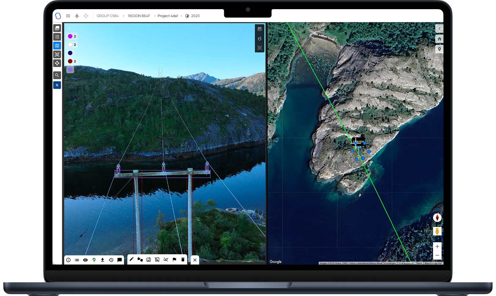
Data is uploaded to the platform directly via data capture partners or via your data lake.
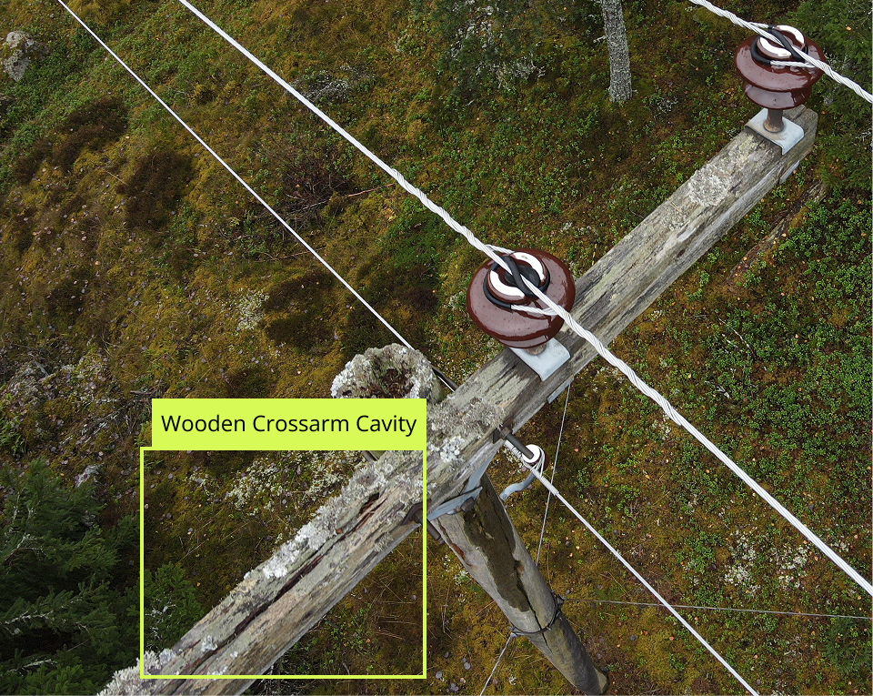
Arkiooon's world leading AI models turn this data into structured data of components, and defects, highlighting faults directly and creating a base for human review.
Arkion's internal team of power grid experts use your standards or reporting to go through data in detail, finding even more faults and ensuring any potential false positives are cleaned out.
Your receive a complete report, high-lighting immediate, severe issues as well as issues that might require action in the coming years.
FAQ
Don’t hesitate to contact us if you have any questions

Arkion integrates with most leading Asset Management Systems (AMS), GIS, and work-order tools through a secure two-way API. Common integrations include SAP, Trimble, Maximo, and ArcGIS, among others, enabling seamless data flow between systems.
Getting started involves three simple steps: 1) Data Review – Arkion reviews your existing data for quality and compatibility. 2) Pilot Analysis – A limited-scope pilot demonstrates analysis accuracy and workflow integration. 3) Scale-Up – The solution is rolled out across your grid, with dashboards, reports, and integrations configured to your needs.
Arkion is a secure, browser-based platform. Users can log in to review data, filter insights, and plan actions through an intuitive map interface and dashboards. Results can also be exported as reports or pushed directly into enterprise systems via API.
Not usually. Arkion maintains a library of more than 100 trained models that cover common components and defect types. These can be immediately applied during onboarding. Custom development is reserved for unique equipment types or conditions outside the existing dataset.
Arkion’s platform supports all major inspection and analytics use cases, including maintenance, vegetation management, asset inventory, and post-storm assessments — across low-, medium-, and high-voltage networks. Additional models can be developed for specialized needs.
Arkion typically requires geotagged imagery or LiDAR data, along with structure metadata such as pole IDs or coordinates. Optional inputs like thermal imagery or flight logs can enhance results but are not mandatory.
Arkion supports industry-standard formats including JPEG, TIFF, PNG, and GeoTIFF for images, LAS/LAZ for LiDAR, and CSV or shapefile-based metadata. The platform can also connect directly to cloud storage or API-based data feeds for seamless ingestion.
Model retraining or fine-tuning is included in service agreements when needed to maintain performance. For new object types or regions requiring dedicated dataset development, Arkion may propose a scoped AI model development project.
Yes. Arkion’s in-house AI and electrical-engineering experts regularly develop custom models for utilities with unique assets or inspection needs. These models are integrated into the platform and benefit from Arkion’s full QA and visualization ecosystem.