Keep vegetation risks under control with AI-powered analysis
Arkion’s vegetation solution detects and measures vegetation proximity, clearance, and risk zones automatically using both LiDAR and imagery. It helps utilities prevent outages, optimize trimming schedules, and ensure full safety compliance—all within one integrated platform.


Benefits
Identify vegetation infringements before they cause faults.
Use quantified data to prioritize where and when to cut.
Ensure regulatory clearance requirements are continuously met.
Measure vegetation risk precisely—before it becomes a problem.
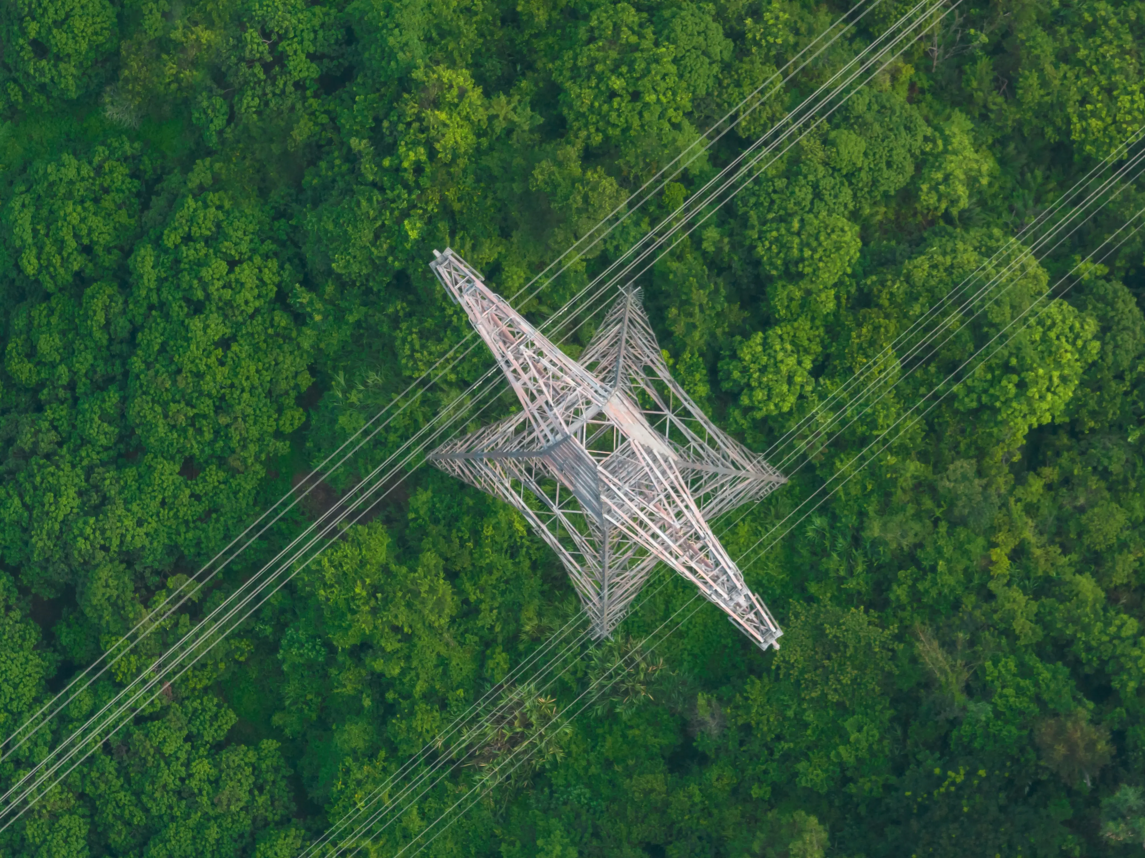
LiDAR-based clearance and infringement measurement
High-resolution 3D modeling calculates exact distances between conductors, ground, and vegetation.
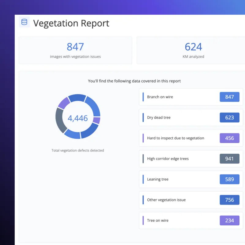
Data can be exported directly to your asset management or GIS system, with span-by-span clearance tables, shapefiles, and Excel/CSV summaries. Combined visual and numeric data help field teams plan and verify trimming work efficiently.
Image-based vegetation detection
By combining multi-year LiDAR and image data, Arkion can highlight fast-growing zones and forecast future risks. Utilities can prioritize trimming cycles, budget more effectively, and extend safe intervals between inspections.
.webp)
Configured for your network, not a one-size-fits-all
Arkion’s clearance rules can be customized to be applied automatically across your entire dataset—ensuring consistent, auditable compliance.

Integrate Results and Combine Data For a Complete Picture
All your findings can be accessed alongside the visualization and reporting tools across Arkion's platform, and integrated into your Asset Management System (AMS) or Work Order systems to drive rapid action.
Cut down your decision time
With Arkion every inspection adds intelligence. Historical data, AI models, and environmental patterns combine to predict where vegetation will cause issues both now and tomorrow.
FAQ

All customer data remains the property of the client. Arkion only processes data under explicit agreement and does not share or reuse customer data outside the scope of contracted services.
Yes. Arkion complies with the EU’s General Data Protection Regulation (GDPR) and equivalent frameworks in other jurisdictions. Data collection, processing, and retention policies are transparent and available upon request.
Arkion minimizes and pseudonymizes all personally identifiable information. Images containing individuals or private property are anonymized using automated image-blurring and masking tools. GPS data is pseudonymized to prevent re-identification.
Data is stored on AWS servers, which can be configured in any AWS region to comply with national or organizational data-residency requirements. Utilities can choose hosting within Europe, North America, or other supported regions.
Arkion is ISO 9001, ISO 14001, and ISO 45001 certified and has implemented a large portion of the COBIT 5 framework, which closely aligns with ISO 27001. Formal ISO 27001 certification is in progress as part of Arkion’s ongoing commitment to data and operational security.
Arkion uses AWS cloud hosting with all data encrypted in transit and at rest. The architecture is built on a secure pipeline including S3, SQS, and Step Functions. Access controls, audit trails, and regular penetration testing by accredited third parties ensure that customer data remains protected.
Yes. Arkion supports data captured from helicopters, ground vehicles, and fixed cameras in addition to drones. As long as the imagery or LiDAR data meets basic resolution and overlap standards, Arkion’s AI models can process and analyze it with the same precision and accuracy.
Arkion serves utilities and service providers globally. The platform supports multi-language, multi-region deployments and is used by customers across Europe, North and South America, and parts of Asia and Oceania. Cloud hosting can be configured regionally to meet local data-residency and compliance requirements.
Yes. Arkion maintains an international network of experienced data-capture partners who can assist with flight planning, data collection, and secure upload to the Arkion platform. Each partner is vetted for safety, regulatory compliance, and quality standards.
No. Arkion focuses entirely on AI analysis and visualization — transforming collected data into actionable insights. However, Arkion collaborates with trusted global partners who perform drone, helicopter, and other inspection flights. If needed, Arkion can connect you with qualified operators to support end-to-end inspection workflows.