
Convert inspection data into detailed asset data
Arkion’s AI automatically identifies, classifies, and maps every component in your power grid—from poles and crossarms to insulators and fittings. The result: a verified, GIS-linked asset inventory ready for reporting, maintenance planning, and regulatory audits.


Impact of better asset data
Build a verified, up-to-date asset database directly from inspection imagery.
Meet documentation requirements with traceable, image-backed records.
Scale inspection data into asset data at minimal extra cost.
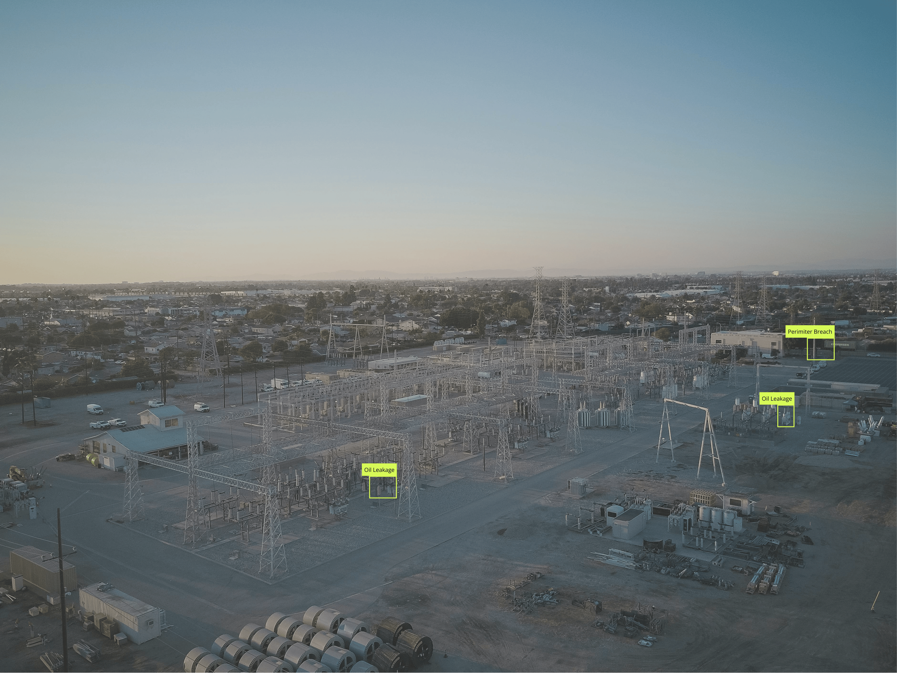
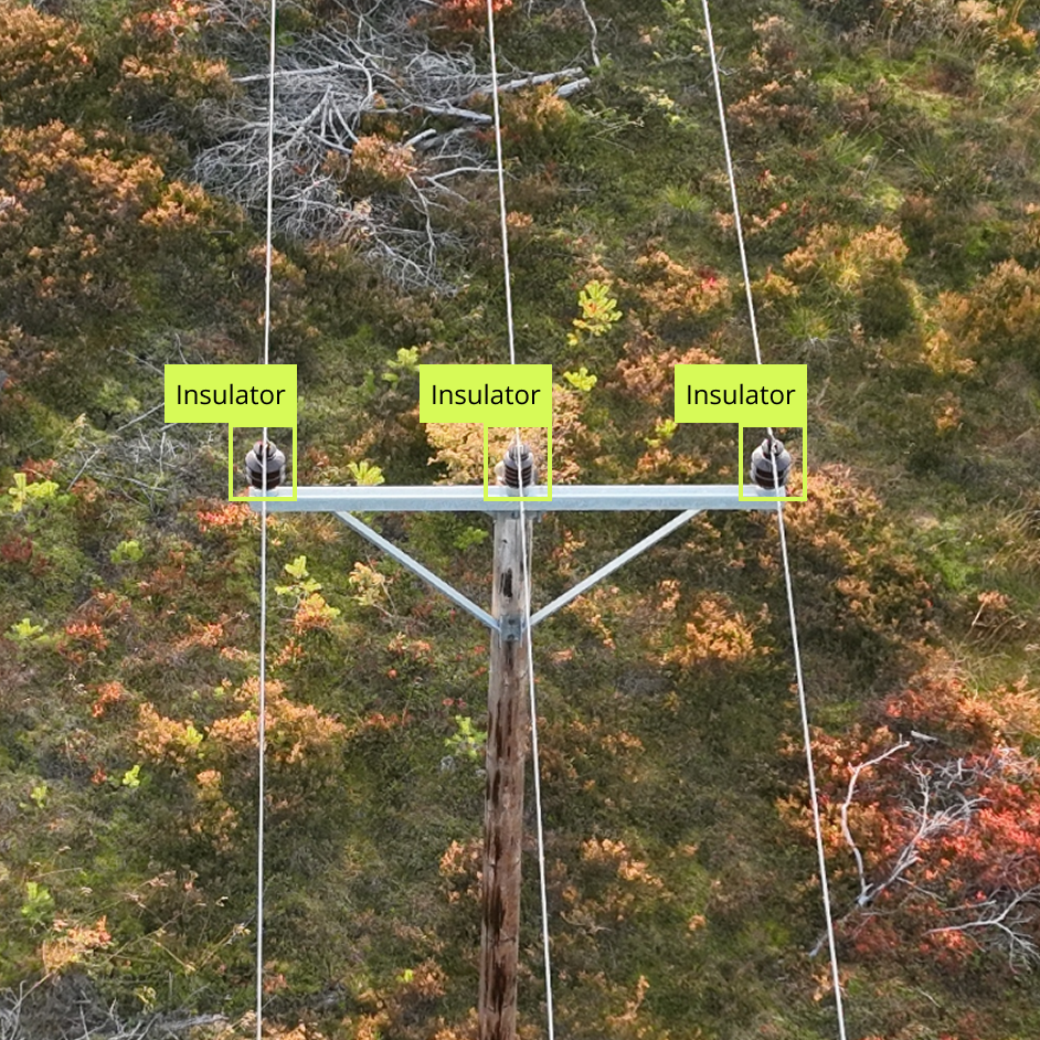
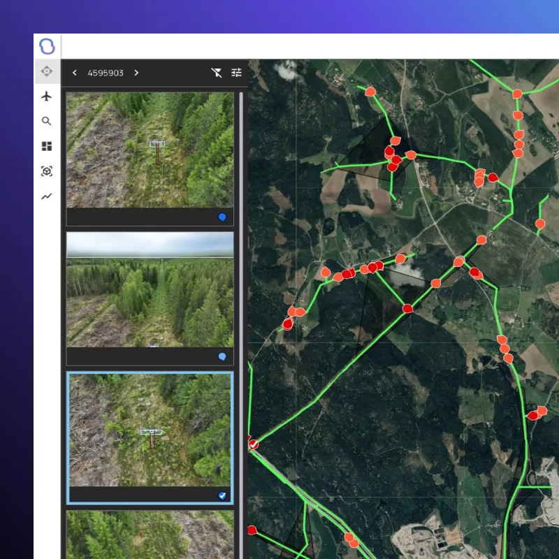
AI models identify and tag every visible part of the grid: poles, insulators, crossarms, clamps, fittings, and more.


Each detected asset is georeferenced and displayed in an interactive map view—connecting visual data with existing GIS layers.
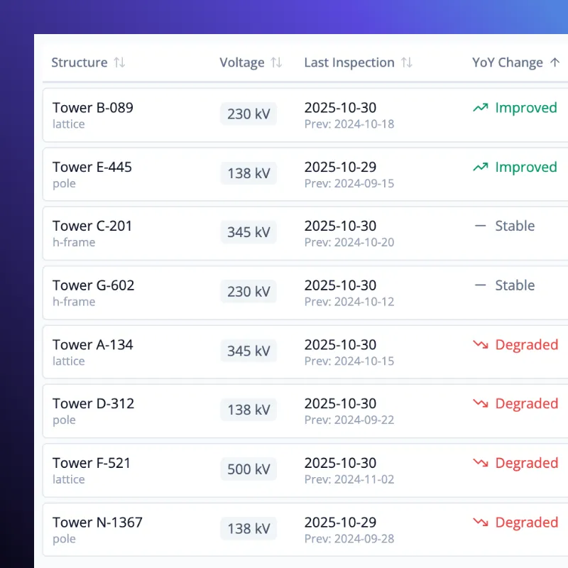
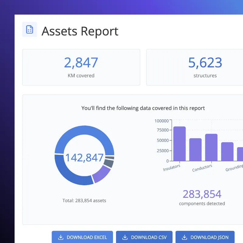
Generate structured asset data exports in CSV, Excel, or GIS formats. Include attributes like asset ID, condition, and location.
Every asset record includes the original inspection image for reference and audit tracking.
AI-powered insights
With Arkion every inspection maps components and structures down to a detailed level, constantly keeping your Asset Management System (AMS) up-to-date and accurate on any development from investment or maintenance operations.

FAQ

All customer data remains the property of the client. Arkion only processes data under explicit agreement and does not share or reuse customer data outside the scope of contracted services.
Yes. Arkion complies with the EU’s General Data Protection Regulation (GDPR) and equivalent frameworks in other jurisdictions. Data collection, processing, and retention policies are transparent and available upon request.
Arkion minimizes and pseudonymizes all personally identifiable information. Images containing individuals or private property are anonymized using automated image-blurring and masking tools. GPS data is pseudonymized to prevent re-identification.
Data is stored on AWS servers, which can be configured in any AWS region to comply with national or organizational data-residency requirements. Utilities can choose hosting within Europe, North America, or other supported regions.
Arkion is ISO 9001, ISO 14001, and ISO 45001 certified and has implemented a large portion of the COBIT 5 framework, which closely aligns with ISO 27001. Formal ISO 27001 certification is in progress as part of Arkion’s ongoing commitment to data and operational security.
Arkion uses AWS cloud hosting with all data encrypted in transit and at rest. The architecture is built on a secure pipeline including S3, SQS, and Step Functions. Access controls, audit trails, and regular penetration testing by accredited third parties ensure that customer data remains protected.
Yes. Arkion supports data captured from helicopters, ground vehicles, and fixed cameras in addition to drones. As long as the imagery or LiDAR data meets basic resolution and overlap standards, Arkion’s AI models can process and analyze it with the same precision and accuracy.
Arkion serves utilities and service providers globally. The platform supports multi-language, multi-region deployments and is used by customers across Europe, North and South America, and parts of Asia and Oceania. Cloud hosting can be configured regionally to meet local data-residency and compliance requirements.
Yes. Arkion maintains an international network of experienced data-capture partners who can assist with flight planning, data collection, and secure upload to the Arkion platform. Each partner is vetted for safety, regulatory compliance, and quality standards.
No. Arkion focuses entirely on AI analysis and visualization — transforming collected data into actionable insights. However, Arkion collaborates with trusted global partners who perform drone, helicopter, and other inspection flights. If needed, Arkion can connect you with qualified operators to support end-to-end inspection workflows.